Humboldt Bay Water Trails Map
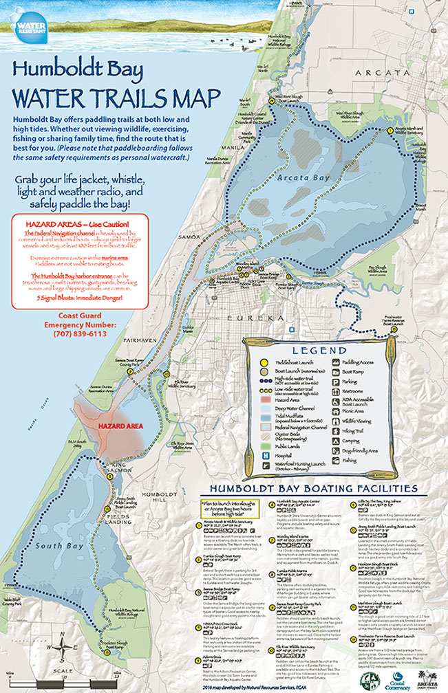
The first version of this map was created by ENC in 2004. It was updated by Redwood Community Action Agency (RCAA) in 2016, in partnership with many local paddling groups (including ENC), government agencies, businesses, and non-profit organizations. Its development was funded by the California Coastal Conservancy and small local contributions. This map is a compilation of local paddling routes around Humboldt Bay, and it is printed on water-resistant paper. You can purchase this map at several locations including the Arcata Marsh Interpretive Center, the Humboldt Bay Aquatic Center in Eureka, the Humboldt Coastal Nature Center in Manila, and Center Activities at Humboldt State University. Find out more at Natural Resource Services, a division of the RCAA. To download the map click here.
Other Maps
- Humboldt County Map, by Humboldt County.
- Map of Humboldt Bay Beaches, Dunes and Wetlands, by Friends of the Dunes, 2013.
- Nautical Chart 18622 of Humboldt Bay, by NOAA, Office of Coast Survey.
- Nautical Chart 18605 Trinidad Harbor, by NOAA, Office of Coast Survey.
- Nautical Chart 18603 St. George Reef and Crescent City Harbor, by NOAA, Office of Coast Survey
- Nautical Chart 18600 Trinidad to Cape Blanco, by NOAA, Office of Coast Survey.
- Nautical Charts and General Use Charts by NOAA, Office of Coast Survey.
- North Coast Refuges, an index map by the Humboldt Bay National Wildlife Refuge.